
Land Portal Glossary: Key Terms Every User Should Know
Whether you're brand new to land investing or already using advanced filters and reports inside Land Portal, you’ll come across a variety of terms related to property data, mapping, land analysis, and lead generation.
This glossary explains many of the most common terms and features you’ll encounter while using Land Portal and evaluating vacant land opportunities. Throughout this guide, we’ll also link to deeper Help Center articles where you can learn more about specific tools and strategies.
Basic Land Investing Terms
Acre
A unit of land measurement equal to 43,560 square feet. Acreage is one of the most important factors when evaluating land value and usability.
Parcel
A specific piece of land identified by the county for tax and ownership purposes.
APN (Assessor Parcel Number)
A unique number assigned to a property by the county assessor to identify a parcel.
Assessed Value
The value assigned to a property by the county for taxation purposes. This is not always the same as market value.
Market Value
The estimated amount a property could realistically sell for in the current market. You can estimate land value inside Land Portal using the LP Estimate and Market Comp tools.
Vacant Land
Land that does not currently contain residential or commercial structures. Most Land Portal users target vacant land because it is often easier to acquire, market, and flip.
Raw Land
Undeveloped land with little or no infrastructure improvements such as utilities or roads.
Rural Land
Property located outside major urban or suburban areas, often used for recreation, agriculture, or investment.
Plat Map
A map that shows how land has been divided into parcels, including lot dimensions, roads, and easements.
Legal Description
The official written description of a property used in deeds and legal records.
Deed
The legal document that transfers ownership of property from one party to another.
Title
The legal ownership rights associated with a property.
Survey
A professional measurement of a property’s boundaries and dimensions.
Boundary Lines
The legal property lines that define the edges of a parcel.
Easement
A legal right allowing someone to use a portion of another person’s property for a specific purpose, such as utilities or road access.
Right of Way
A type of easement that allows access across a property, commonly used for roads or driveways.
Utility Easement
An easement that allows utility companies access to install or maintain power, water, sewer, or communication lines.
Road Access
The ability to legally and physically reach a property by road.
Access Easement
An easement that provides legal access to a property that may not directly touch a public road.
Road Frontage
The amount of a property that directly borders a road. Road frontage can impact accessibility, value, and subdivision potential.
Landlocked Property
A property that does not have legal road access to a public road. These properties can sometimes be purchased at discounts, but they also carry additional risk.
Terrain & Land Characteristics
Topography
The physical shape and elevation changes of land.
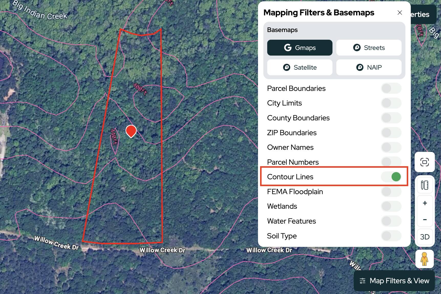
Contour Lines
Lines on a map that represent elevation changes and help visualize the slope and terrain of a property.
Elevation
The height of land above sea level.
Slope
The steepness or incline of land. Slope is important for buildability, drainage, and usability.
Floodplain
An area of land that has a higher risk of flooding.
FEMA Flood Zone
A flood risk classification assigned by FEMA that indicates the likelihood of flooding on a property.
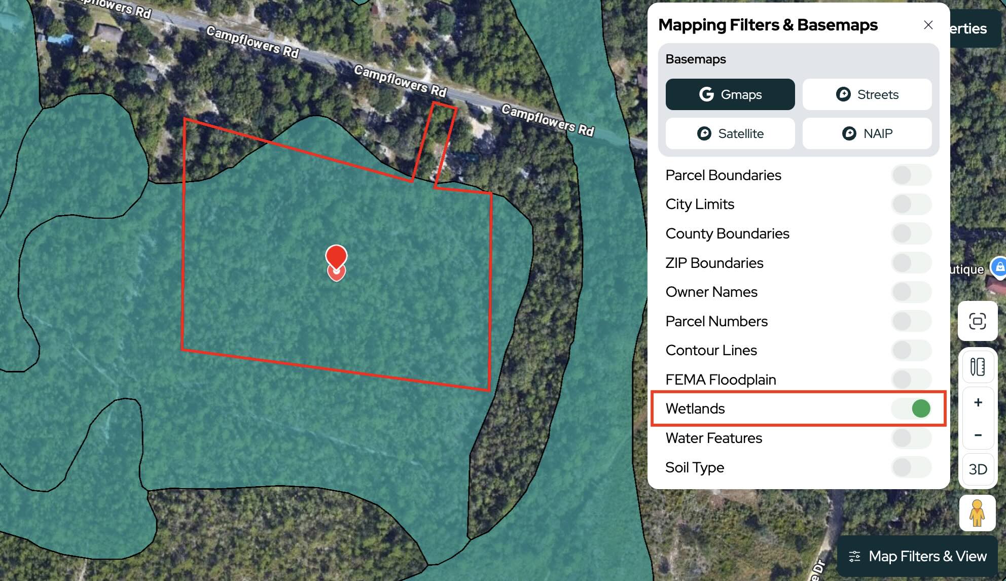
Wetlands
Areas where water is present at or near the surface for extended periods. Wetlands can impact development and land usability.
Drainage
The way water moves across or through a property.
Pond
A small body of standing water located on a property.
Buildable Area
The portion of a property that can realistically be developed or built on.
Usable Acreage
The amount of land on a property that is practical for use or development after accounting for wetlands, steep slopes, flood zones, or setbacks.
GIS Mapping
Geographic Information System mapping technology used to display property data and overlays visually on a map.
Satellite Imagery
Aerial imagery captured from satellites that allows users to visually inspect land and surrounding areas.
NAIP Imagery
High resolution aerial imagery provided through the National Agriculture Imagery Program.
Zoning & Land Use Terms
Zoning
Rules established by local governments that determine how land can be used.
Zoning Code
A specific code assigned to a property’s zoning classification.
Agricultural Zoning
Zoning intended primarily for farming or agricultural uses.
Residential Zoning
Zoning intended for homes and residential development.
Commercial Zoning
Zoning intended for businesses and commercial activity.
Mixed Use
Zoning that allows multiple property uses, such as residential and commercial together.
HOA (Homeowners Association)
An organization that establishes and enforces rules within a neighborhood or subdivision.
Deed Restrictions
Private restrictions placed on how a property can be used.
Minimum Lot Size
The smallest parcel size allowed under local zoning regulations.
Manufactured Home Restrictions
Restrictions related to placing manufactured or mobile homes on a property.
RV Restrictions
Restrictions regarding recreational vehicle usage or living arrangements on a property.
Subdividable Land
Land that may legally be split into smaller parcels.
Rezoning
The process of changing a property’s zoning classification.
Land Portal Terms & Features
Map Search
The main search interface inside Land Portal where users apply county, acreage, ownership, and other property filters.
Advanced Filters
Additional filtering options that allow users to target properties more precisely.
Basemap
The main background map used in Land Portal, such as Streets, Satellite, or NAIP imagery.
Parcel Boundaries
A map filter showing property boundary lines.
Owner Overlay
A map filter displaying owner names directly on the map.
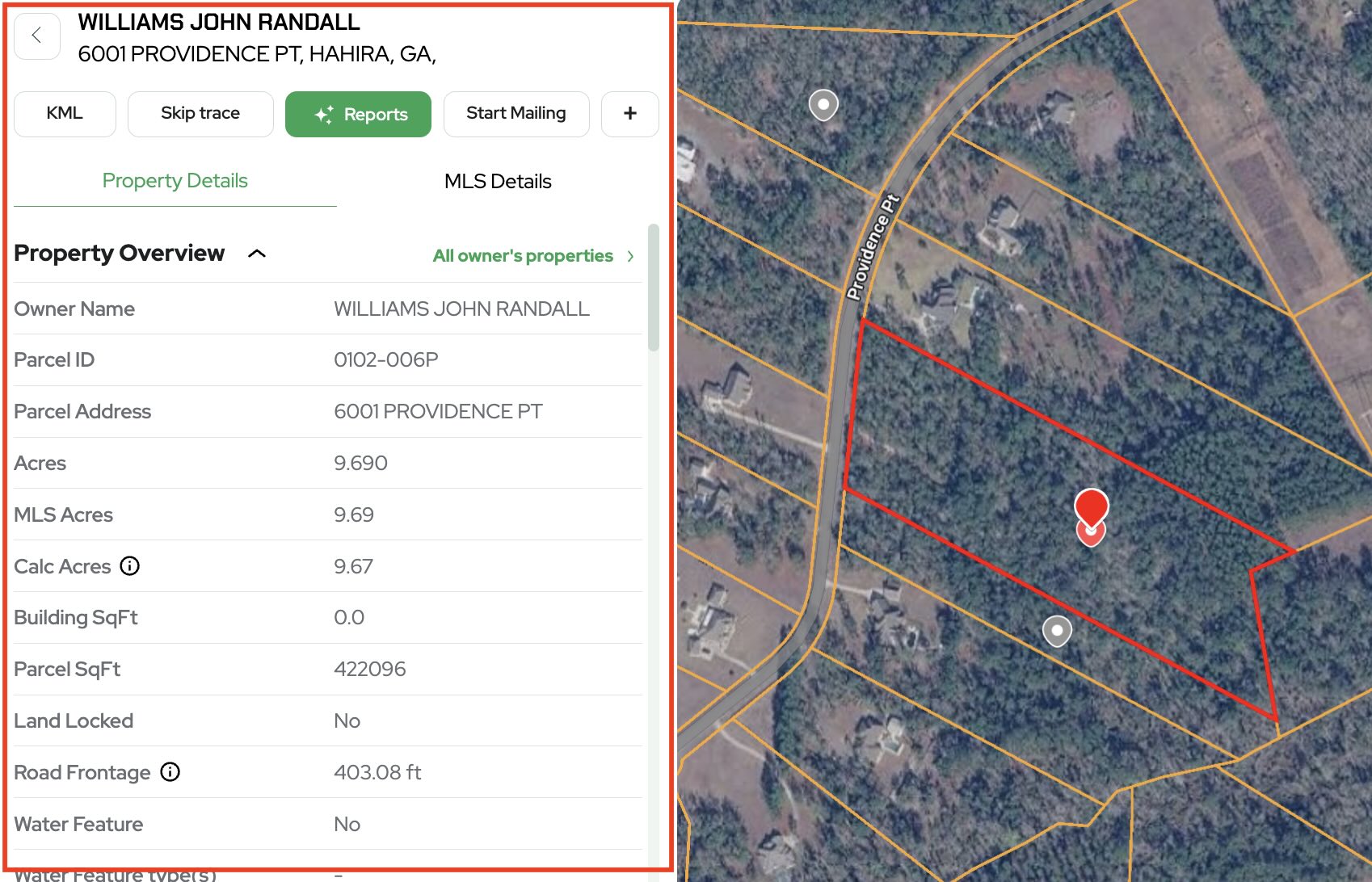
Property Card
The detailed property information panel inside Land Portal that contains ownership data, acreage, maps, tax data, and property details.
List View
A spreadsheet style view showing filtered property results in a sortable list format.
Export
The process of downloading filtered property data from Land Portal.
CSV Export
A downloadable spreadsheet style export format commonly used for direct mail campaigns and lead management.
Skip Trace
A feature that helps users obtain contact information for property owners, including phone numbers and mailing details. Land Portal offers both bulk skip tracing and single property skip tracing directly from the Property Card.
Mailing List
A list of property owners generated for direct mail marketing campaigns.
Saved Search
A saved set of search filters that can be reused later.
Area Measurement Tool
A mapping tool used to measure acreage or property size directly on the map.
Line Measurement Tool
A tool used to measure distances such as road frontage or driveway length.
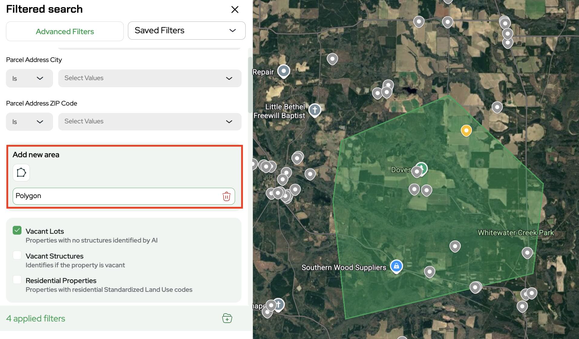
Polygon Tool
A drawing tool that allows users to outline a custom target area directly on the map for property searches.
Market Comp Report
A report that analyzes comparable property sales to help estimate land value.
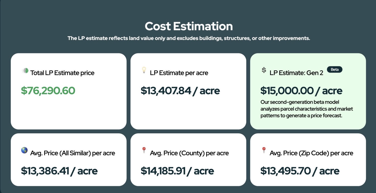
LP Estimate
Land Portal’s estimated property value calculation based on market data and comparable sales.
LP Intelligence
Land Portal’s AI powered market research assistant designed to help users analyze markets and property opportunities.
Comparable Sales (Comps)
Recently sold properties that are used to estimate the value of another property.
MLS Data
Property listing and sales data sourced from the Multiple Listing Service.
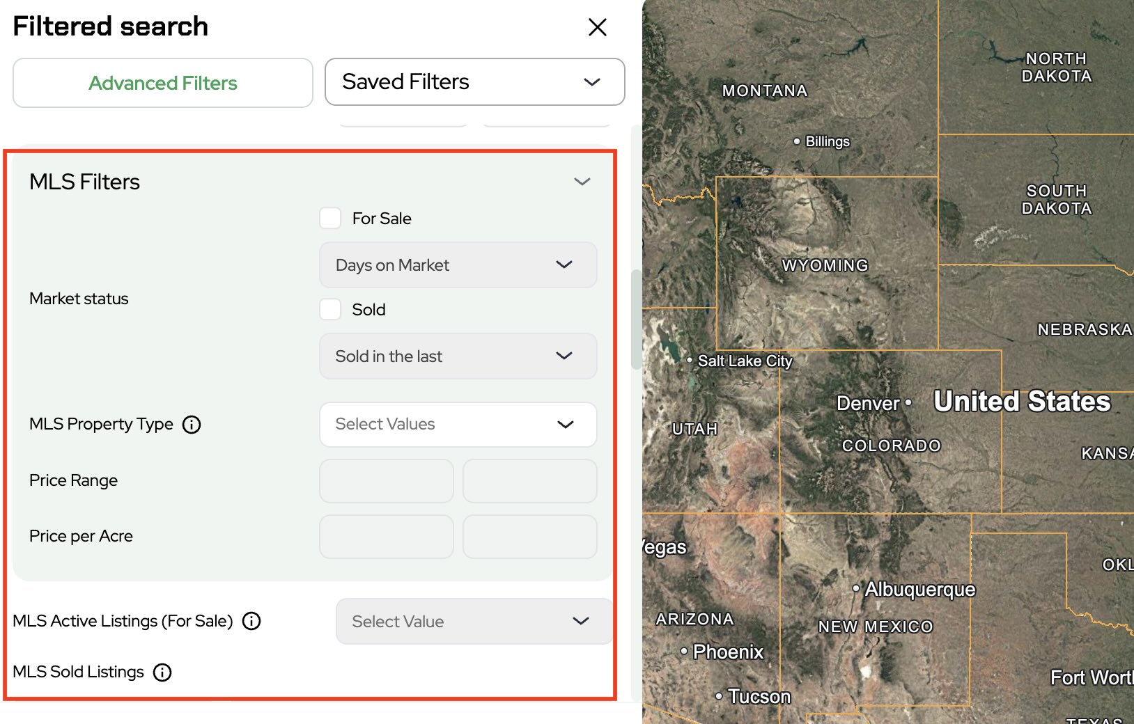
MLS Filters
Filters that allow users to search active and sold MLS listings directly inside Land Portal.
Slope Report
A report showing the steepness and terrain characteristics of a property.
Survey Hack
A strategy where an investor identifies a larger property and surveys off a portion of it to purchase or sell separately.
Buyer Search
A process used to identify active land buyers and investors within a target market.
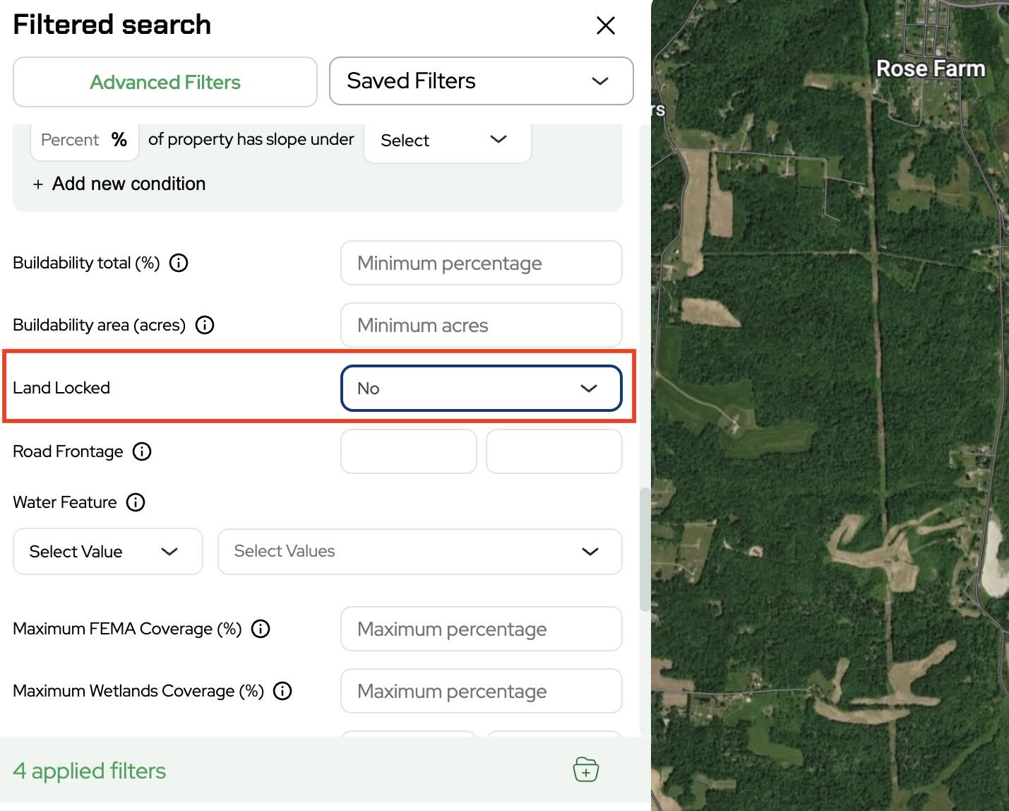
Landlocked Filter
A filter used to identify properties without legal road access.
Road Frontage Filter
A filter used to target properties based on the amount of road frontage.
Water Features Filter
A filter that allows users to find properties with or without specific water features, such as ponds, creeks, streams, rivers, or lakes.
Wetlands Filter
A filter used to identify or exclude properties based on wetlands coverage percentage.
Recently Sold Filter
A filter used to exclude or target properties based on recent sale activity.
Zoning Filter
A filter used to target properties based on zoning classifications.
Owner Property Count
A filter showing how many properties an owner currently owns.
Last Sale Date
The recorded date of the property’s most recent sale transaction.
Out-of-State Owners
Property owners whose mailing address is located outside the state where the property exists.
Absentee Owners
Owners whose mailing address differs from the property address.
Marketing & Lead Generation Terms
Direct Mail
Marketing campaigns that involve sending letters or postcards to property owners.
Cold Calling
Calling property owners directly to discuss buying or selling land.
SMS Marketing
Sending text message campaigns to property owners or buyers.
Lead List
A list of targeted property owners generated through filtering criteria.
Motivated Seller
A property owner who may be more willing to sell quickly or at a discount.
Campaign
A coordinated marketing effort targeting a group of property owners.
Buyer List
A list of buyers interested in purchasing land in a certain market.
Cash Buyer
A buyer purchasing property without financing.
Target County
The county selected for property searches or marketing campaigns.
Final Thoughts
If you're serious about land investing and want access to powerful property data, map analysis tools, AI research features, and targeted filtering capabilities, login to Land Portal to streamline your land investing process and find better deals faster.