
How to Understand Soil Types in Land Portal
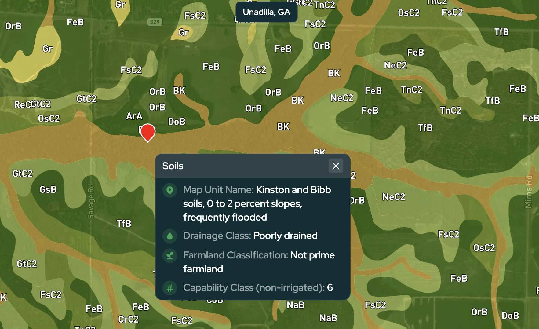
When researching land, soil conditions can tell you a lot about a property beyond what you can see from an aerial map.
Soil data can provide insight into drainage, agricultural potential, slope, and other characteristics that may affect how a property can be used. With the Soil Type overlay in Land Portal, you can quickly explore this information for a specific property or across an entire area.
In this article, we'll walk through how to use the Soil Type overlay and explain what the information means when you select different areas on the map.
Step by step walkthrough
- Login to Land Portal
Log in to your Land Portal account and navigate to the map.
- Find a Property or Area You Want to Research
Search for a specific property, or navigate to an area where you want to learn more about the soil conditions.
You don't need to have a specific parcel selected. The Soil Type overlay can also be useful when researching a larger area or comparing different locations.
- Turn On the Soil Type Overlay
Open the map overlays and turn on the Soil Type overlay.
Once enabled, the map will display different colored areas along with abbreviations such as GaF, PeD, WcA, CkB, and others.
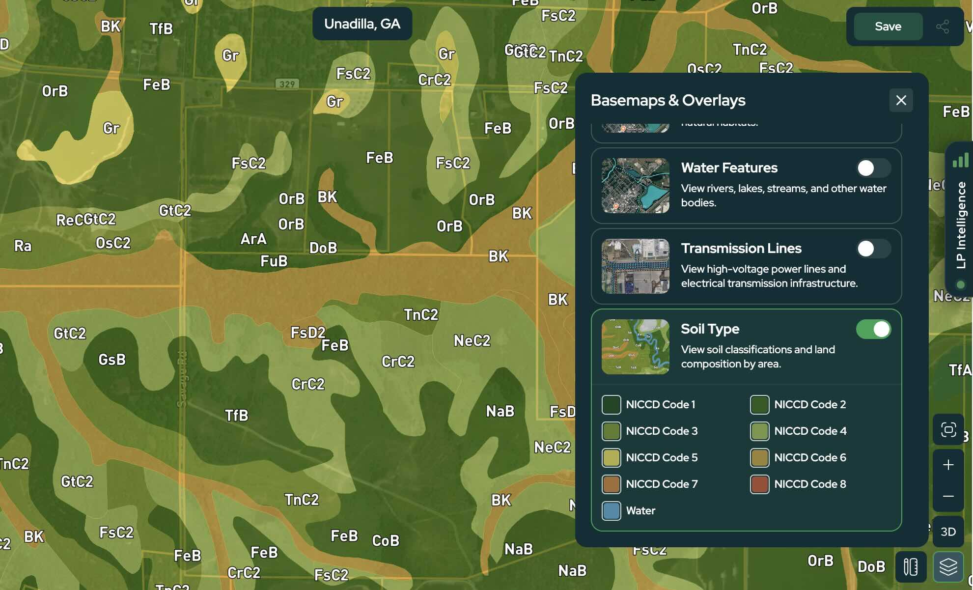
These abbreviations are soil map unit symbols used to identify the different mapped soil areas. The symbols and soil types vary by location, so you don't need to memorize what each code means.
Instead, you can select any area on the map to see more information about that soil.
- Select an Area to View Soil Details
Move around the map and click on any soil area you want to learn more about.
Land Portal will display several pieces of information for that soil map unit, including:
- Map Unit Name
- Drainage Class
- Farmland Classification
- Capability Class (non-irrigated)
Even areas located close to one another can have very different soil characteristics, so it's worth exploring different sections of a property or surrounding area.
Understanding the Soil Information
The individual soil names and map unit symbols will change depending on where you're researching, but the information displayed by Land Portal can be interpreted the same way.
Map Unit Name
The Map Unit Name identifies the mapped soil unit you're viewing.
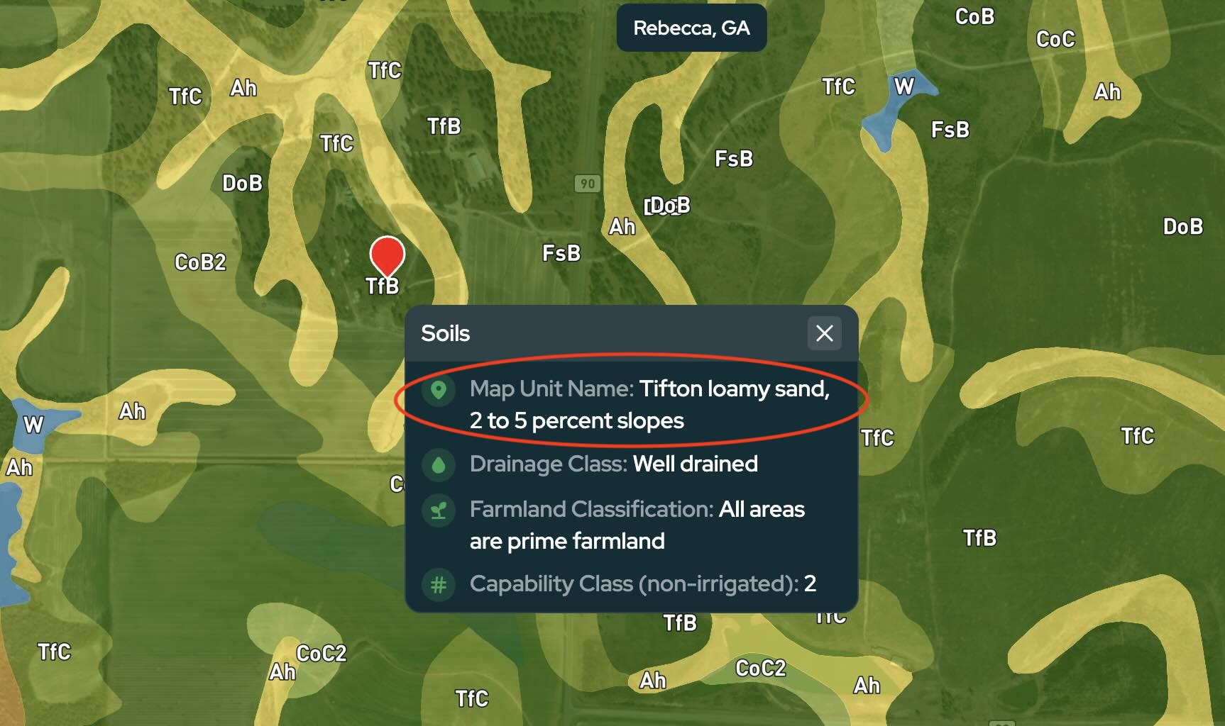
For example, in the map above, you may see:
Tifton loamy sand, 2 to 5 percent slopes
The first part identifies the mapped soil, while the percentage indicates the range of slopes associated with that particular soil map unit.
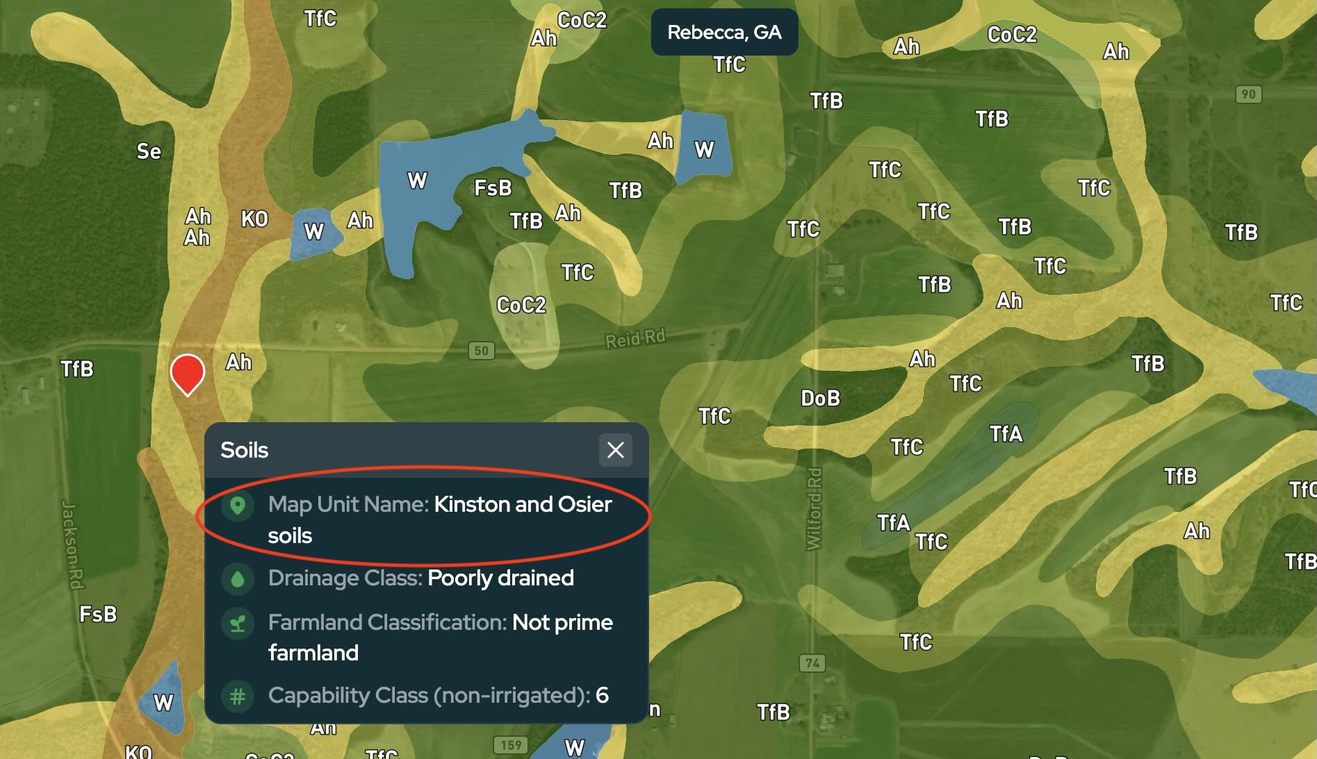
Other areas may display a different type of map unit, such as:
Kinston and Osier soils
Not every Map Unit Name will include a slope range. The information shown depends on how that particular soil map unit is classified.
This is why it can be helpful to click around different parts of a property or surrounding area.
Soil types and their characteristics can change even across relatively short distances.
Keep in mind that the slope shown here is part of the soil map unit classification. If terrain or buildability is an important part of your property research, use Land Portal's dedicated Slope Analysis and Buildability tools for a more detailed look at the parcel.
Drainage Class
The Drainage Class describes how readily water moves through or away from the soil under natural conditions.
Depending on the soil, you may see classifications ranging from excessively drained to very poorly drained.
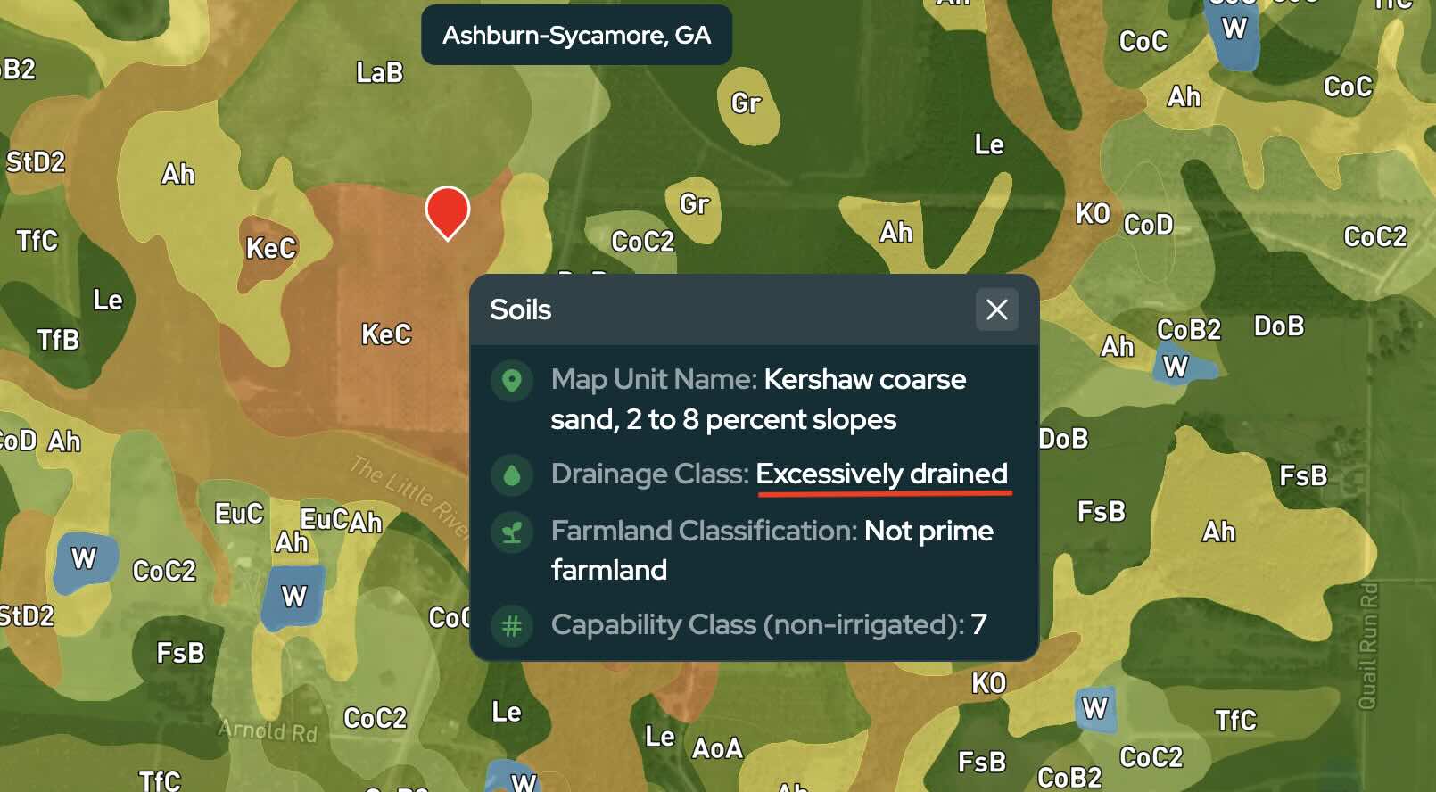
In general, well-drained soils allow water to move away more readily, while poorly or very poorly drained soils are more likely to remain wet for periods of time.
For land investors, drainage can be an important clue during due diligence. Poor drainage may be a reason to investigate further if you're considering building, septic, agriculture, or another use where soil and water conditions matter.
However, poorly drained soil does not automatically mean an area is a wetland. If you have concerns about wetlands, turn on Land Portal's Wetlands overlay and conduct any additional due diligence needed for the property.
Farmland Classification
The Farmland Classification provides information about the soil's suitability for agricultural production.
Depending on the area, you may see classifications such as:
- Prime farmland
- Prime farmland if drained
- Not prime farmland
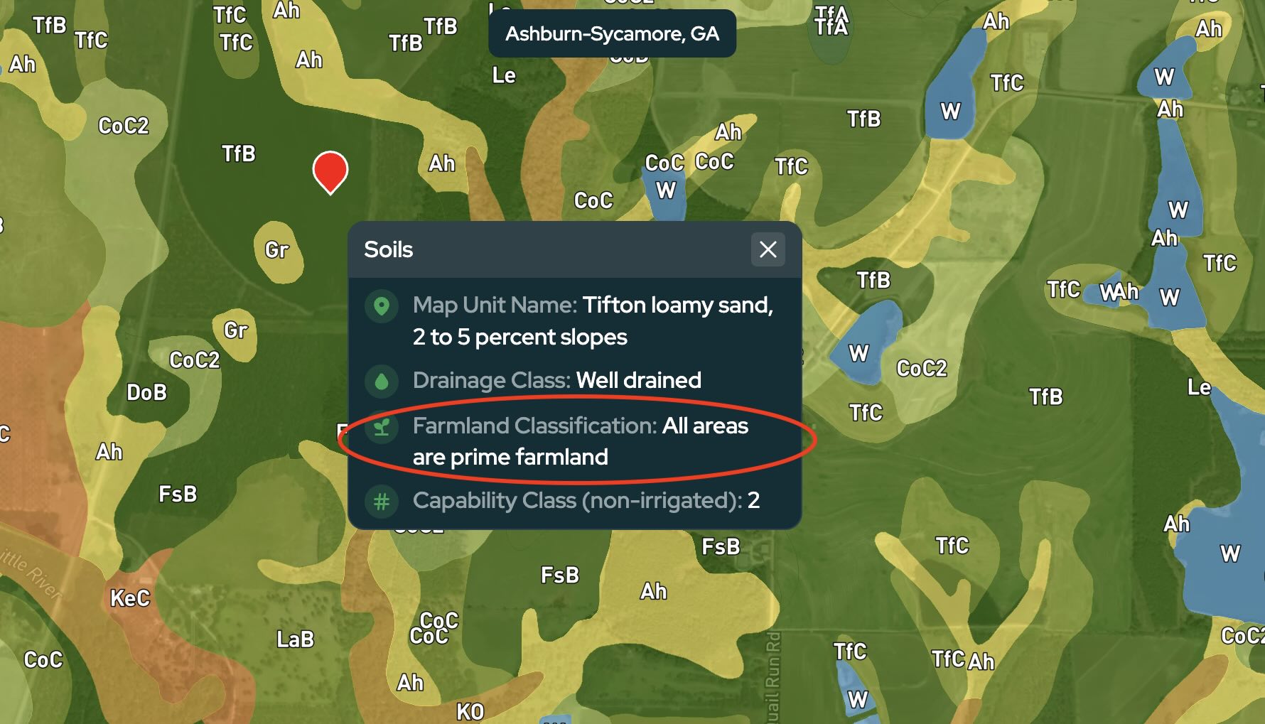
Prime farmland generally refers to land with soil characteristics favorable for producing crops when properly managed.
A classification such as Prime farmland if drained indicates that drainage is one of the conditions affecting whether the soil meets the criteria for prime farmland.
It's also important not to interpret Not prime farmland as meaning the property is bad or unusable. This is an agricultural classification and doesn't determine whether the land is suitable for building, recreation, investment, or another use.
Capability Class (Non-Irrigated)
The Capability Class provides another way of understanding the agricultural limitations of the soil.
Land capability classes range from 1 through 8. As the number increases, the land generally has greater limitations for cultivated agricultural use.
As a general reference:
- Classes 1–4 have increasing limitations but may still be suitable for cultivated agricultural use.
- Classes 5–7 have more significant limitations that restrict cultivation.
- Class 8 has limitations that generally prevent commercial crop production.
For example, a soil with a Capability Class of 2 generally has fewer agricultural limitations than one with a Capability Class of 7.
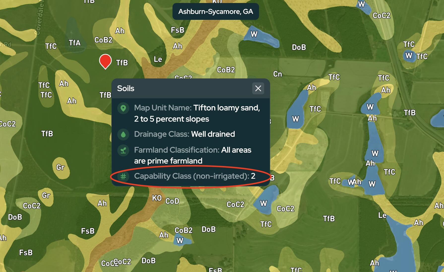
Again, this classification is focused on agricultural use. A higher capability class doesn't automatically mean a property is unsuitable for other uses or a poor investment.
Using Soil Data During Land Research
The Soils overlay gives you another layer of information to consider when evaluating a property or researching a new area.
Rather than looking for a "good" or "bad" soil type, use the information to identify characteristics that may require additional research.
Very poor drainage, for example, could lead you to investigate water and wetland conditions more closely. A steep slope range could warrant a closer look at the property's terrain and buildable areas. Farmland and capability classifications can provide additional context when evaluating agricultural property.
Soil data should be used as one part of your overall due diligence rather than a pass-or-fail test for a property.
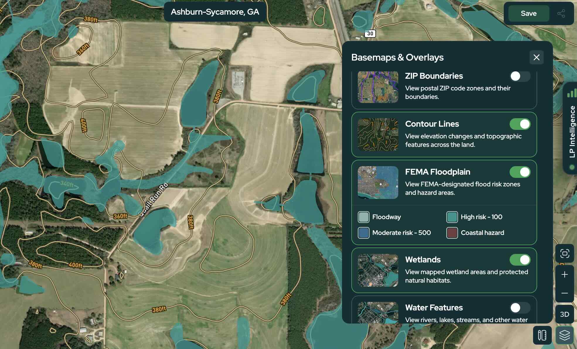
Combine the Soils overlay with Land Portal's Wetlands, FEMA Flood, Slope, Contour Lines, and Buildability tools to develop a more complete picture of the land before making an investment decision.
Learn More About Soil Data
The soil information displayed in Land Portal is based on standardized soil survey data and classifications. If you'd like to learn more about soil data or conduct additional research, the USDA Natural Resources Conservation Service (NRCS) provides official resources for understanding and exploring soil information.
USDA NRCS Web Soil Survey Use the official Web Soil Survey to explore detailed USDA soil information and reports for specific areas.
USDA NRCS Soil Survey Learn more about soil surveys, the information they contain, and how soil characteristics are mapped and interpreted.